
A Fortress Built for a Painting, and the Waterfall Over the Pass
Every fortress guards something. Wibongsanseong Fortress, strung across a mountain pass in Wanju, was built to guard a painting. When the Joseon court raised these walls between 1675 and 1682, the enemy they had in mind would not be coming for grain or territory but for a portrait of King Taejo, the dynasty’s founder, enshrined in nearby Jeonju. Dynastic legitimacy lived in that canvas. If Jeonju ever fell, the portrait needed somewhere to run — and this eight-and-a-half-kilometer ring of stone, with a shrine-palace inside it, was the escape plan. Which makes Wibongsanseong that rare thing: a fortress whose entire strategic purpose was one object’s evacuation route.
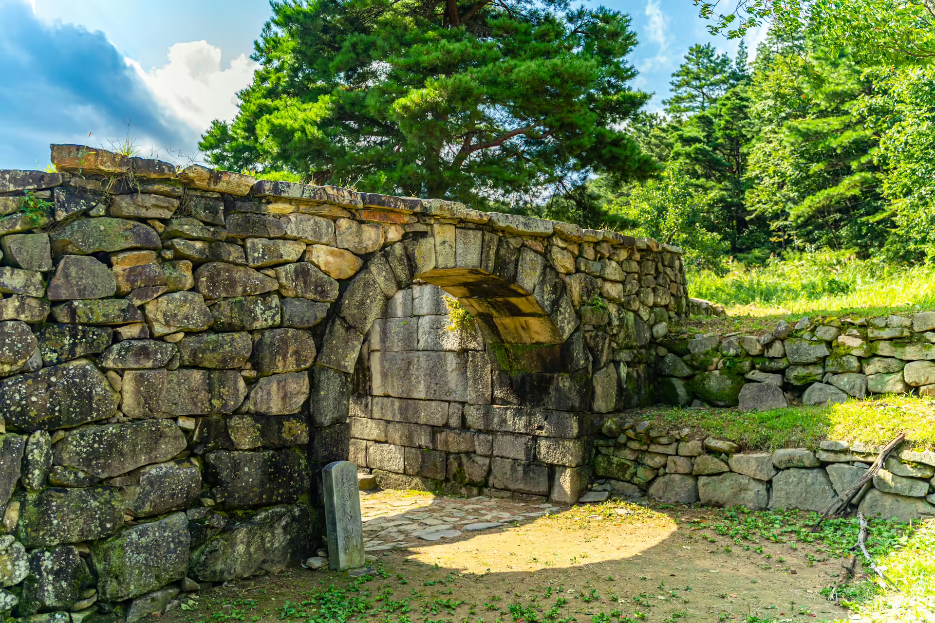
The plan was used exactly once, and it worked — mostly. In 1894, the Donghak peasant revolution — Korea’s great uprising of farmers against corrupt officialdom, and the spark that dragged foreign armies onto the peninsula — reached Jeonju and took the city. The portrait and royal tablets were rushed up this pass. By then the fortress shrine had decayed, so the treasures rode out the emergency in the main hall of Wibongsa, the temple inside the walls, before returning home. Not a single shot is recorded as ever being fired at the walls themselves. As military history goes it is gloriously anticlimactic, and standing at the arched West Gate today, you can read the whole episode in the stones: a fortress that spent two centuries waiting for one week of usefulness.
Orientation
The fortress pass sits about 35–40 minutes by car from Jeonju, immediately uphill from Oseong Hanok Village — the gate area is a ten-minute drive from the village, and Songgwangsa Temple is on the same road down in the flats, so the three chain into an easy half day. Public transport is a thin local bus that appears a handful of times daily; drive. Everything in this article is free: no ticket booth at the fortress, the temple, or the falls. Wear real shoes — the wall paths are uneven — and if rain has just passed, go straight to the falls first. You will see why. Count on ninety minutes to two hours for the pair: half an hour of wall, twenty minutes at the temple, and the rest at the falls, more if the water is running hard and you take the lower deck at a respectful pace.
Walking the Walls
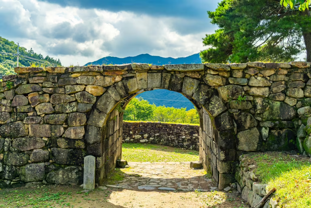
The obvious entry is the West Gate area at the top of the pass, where an arched stone gateway — the fortress’s photogenic centerpiece — frames the road that once carried the portrait. From it, restored stretches of wall run along the ridgeline in both directions, dipping and climbing with the terrain. The masonry alternates between original weathered courses and newer restoration, and the contrast is honest rather than disguised: you can read the fortress’s centuries like tree rings, gray lichen against pale cut stone.
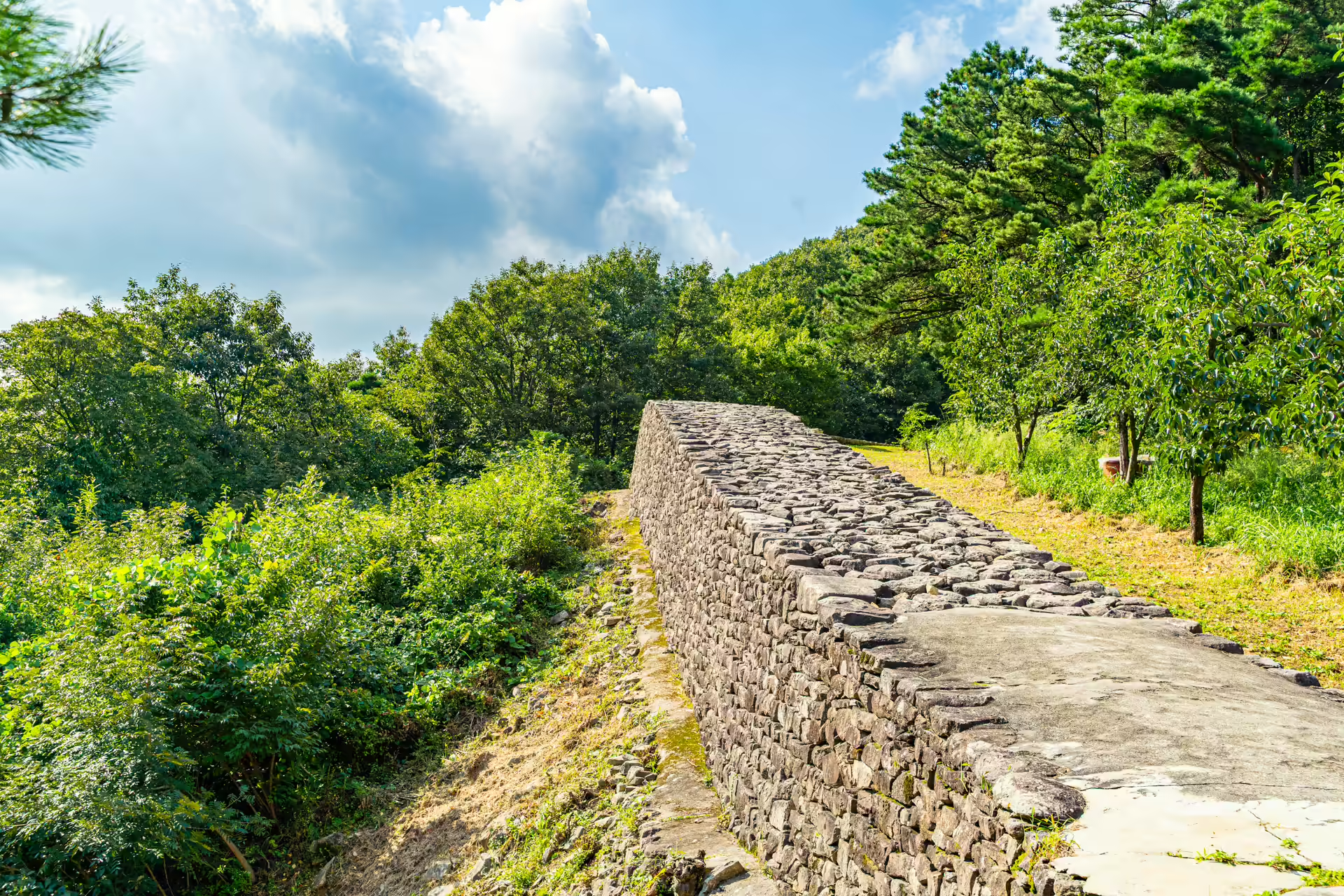
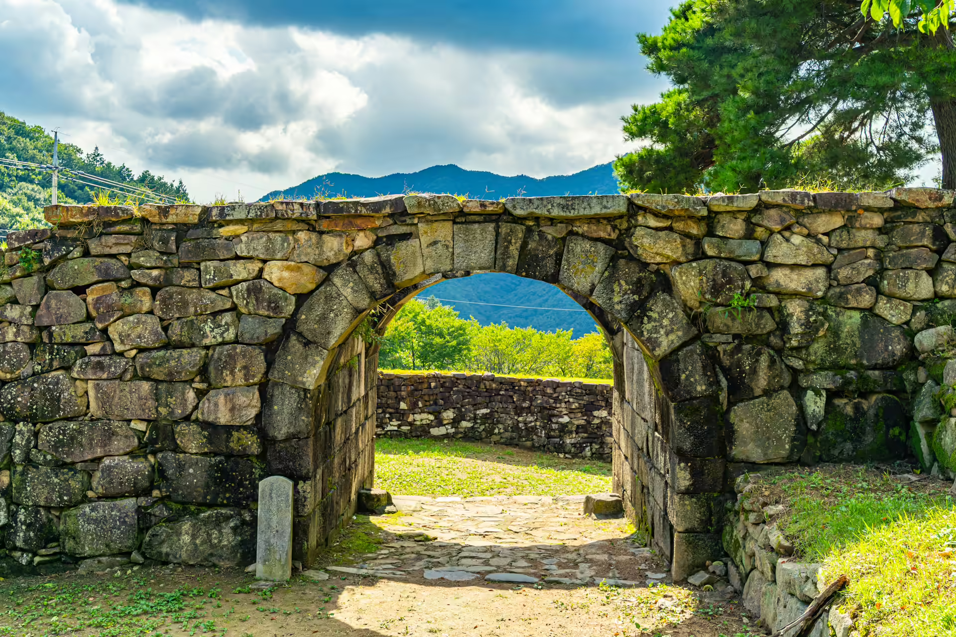
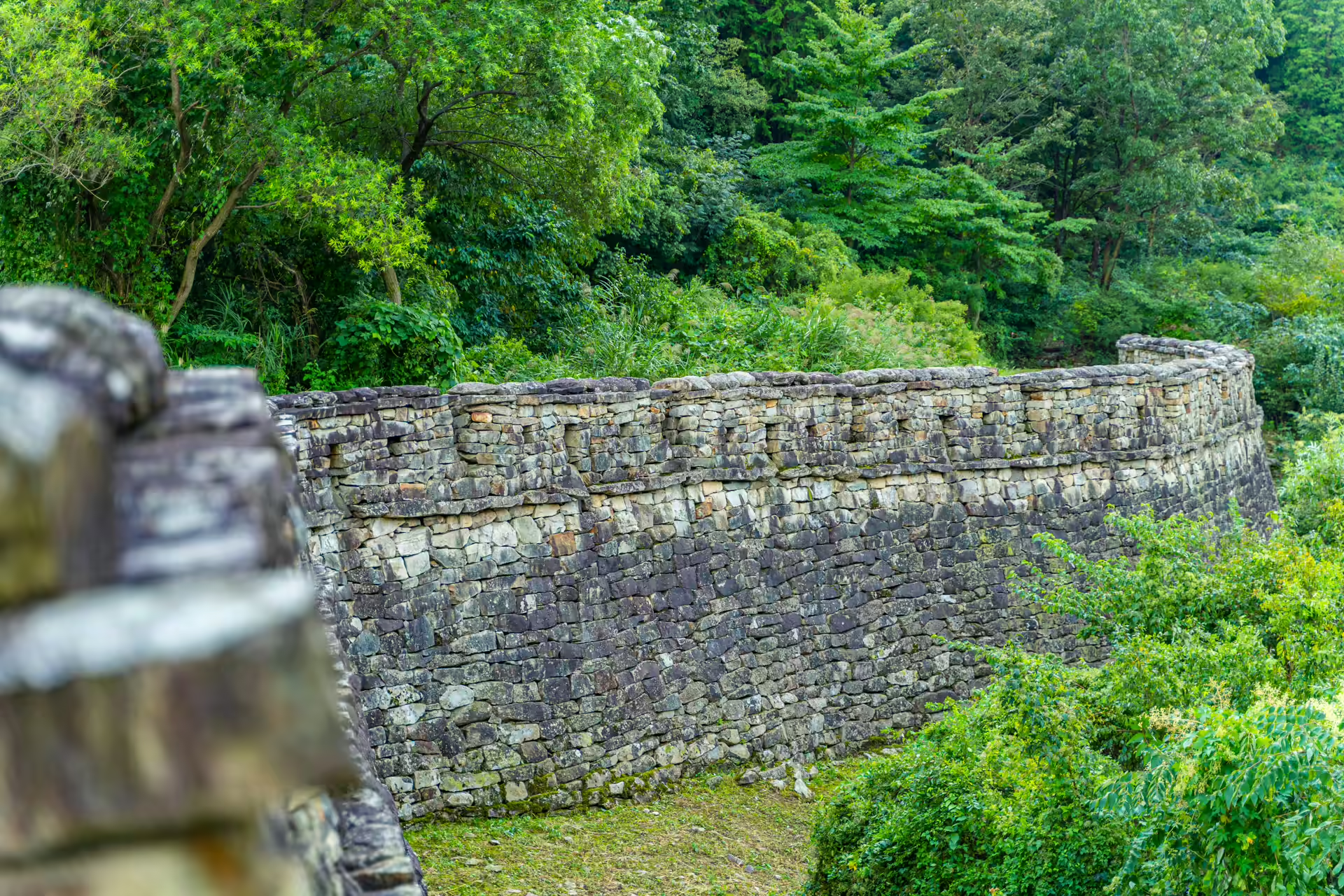
Do not attempt the full circuit casually — 8.5 kilometers of ridge wall is a serious hike, and most of the perimeter is unrestored scramble. The rewarding stretch is the half hour around the West Gate: wall, pine forest, and long views back down the valley you drove up. The gate itself is the shot everyone comes for, and it has two good angles — head-on from the road below, where the arch frames sky, and from the wall shoulder above, where the whole curve of the rampart pours away downhill behind it. Morning light favors the outer face, late afternoon the inner. What surprises first-timers is that the fortress interior is not empty parkland but a working landscape — the little settlement of Wibong hamlet has lived inside the walls for generations, fields and all. A fortress with a village in its pocket: persimmon trees against the ramparts, a dog announcing you two farms early, agriculture proceeding inside a national historic site as if the designation were somebody else’s business.
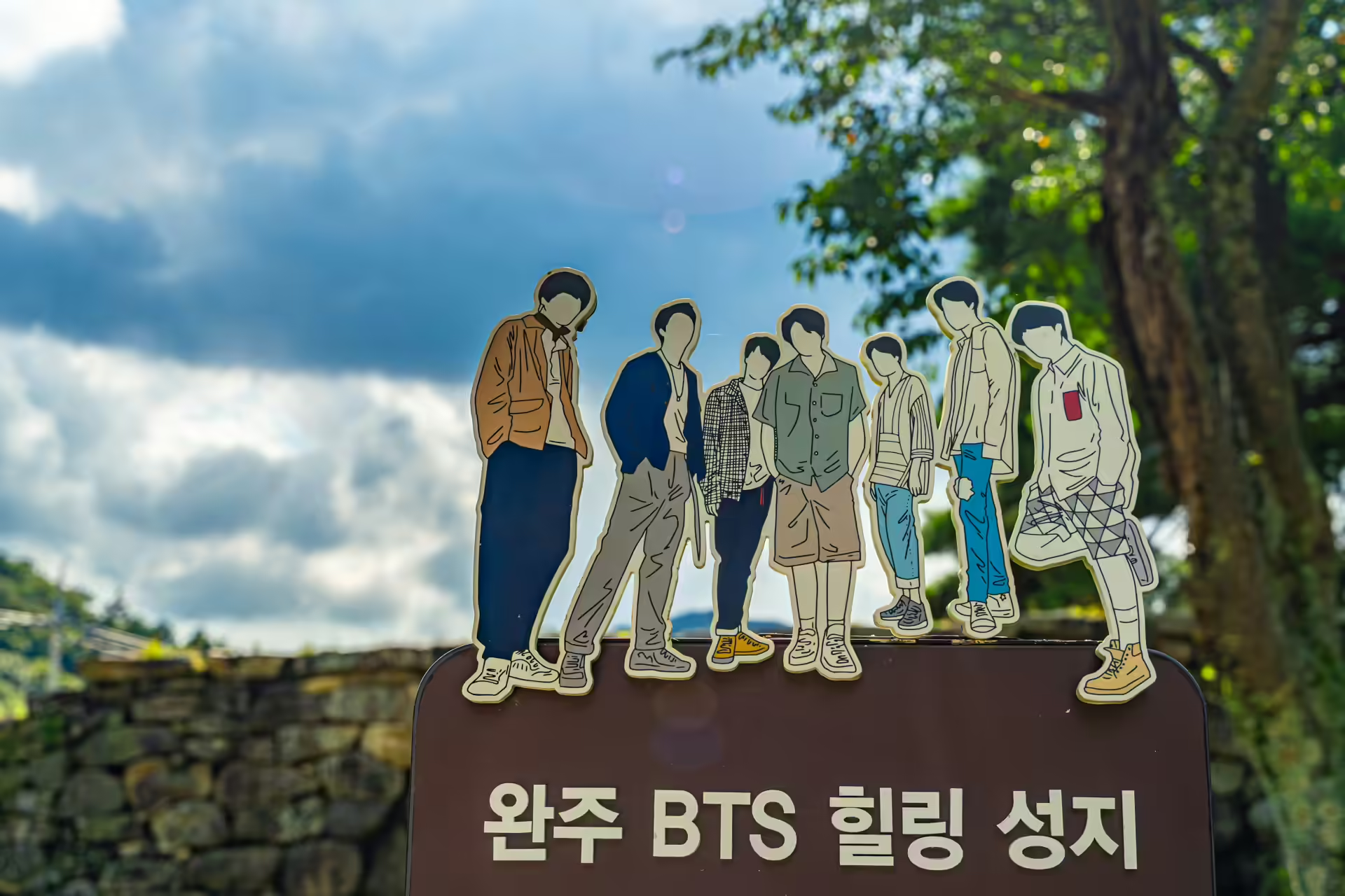
And yes: the sign at the gate with seven cartoon silhouettes is official. BTS shot part of their 2019 Summer Package around the West Gate, and Wanju County has marked it as a stop on its “K-POP Healing Sanctuary” trail. On my visit the only other people at the gate were two fans photographing the sign and an elderly farmer on a scooter passing through it, both parties entirely unbothered by each other — Awon, where the group actually lodged, sits just down the mountain if you are building the full pilgrimage.
Inside the walls, a short drive on, Wibongsa temple is worth twenty unhurried minutes: a compact nuns’ monastery said to date to 604, whose Bogwangmyeongjeon hall — a state Treasure, probably 17th century, with a famous white-robed Guanyin painted on the wall behind the altar — repaid the fortress’s hospitality by sheltering the royal portrait through the 1894 emergency. The temple once ranked among the region’s major monasteries, with dozens of branch temples under its authority and, in the fortress era, a formal duty to help garrison the walls; today it has contracted into something better, a small, immaculately swept compound where the loudest event of the afternoon is a wind chime. If the fortress gate is the valley’s history lesson, the temple is its retirement.
Over the Pass: Sixty Meters of Falling Water
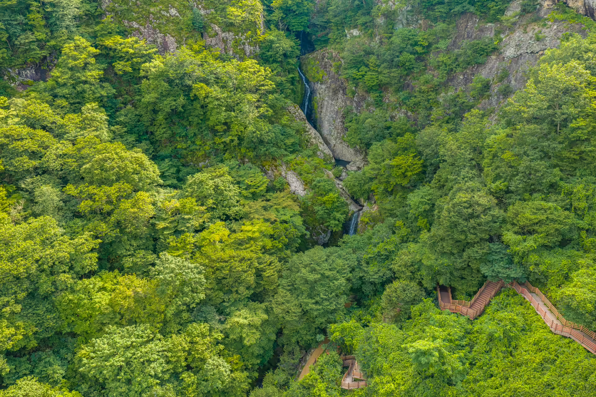
Cross the pass and the road tips into a different watershed; a couple of bends later, a gorge opens on your right and there it is — Wibong Falls, dropping roughly 60 meters in two linked tiers down a rock face wrapped in old-growth green. This was a scenic celebrity long before cameras: painters and travelers counted it among the Eight Views of Wansan (the old name for the Jeonju region), and in 2021 the state formalized the reputation, designating the falls and their surroundings a national Scenic Site.
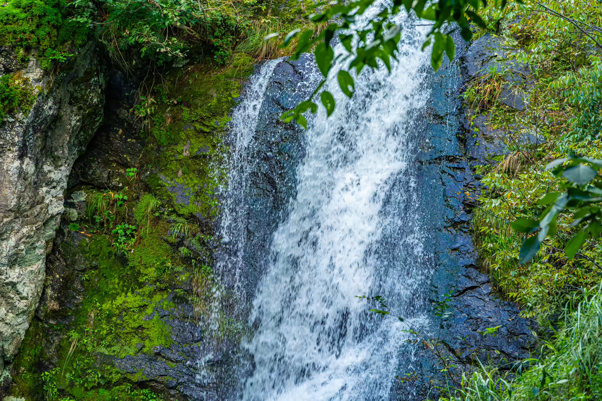
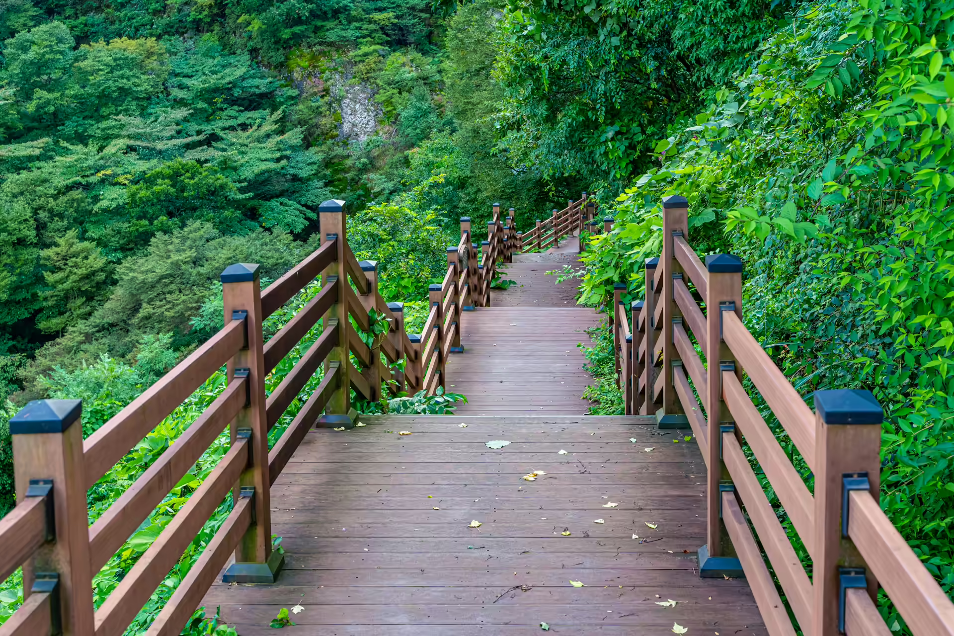
Two vantage points, two personalities. From the roadside pavilion at the top — there is a small pull-off for cars — you get the full two-tier composition at a distance, hung in its gorge like the ink paintings it inspired. Then a wooden stair deck switchbacks down the slope to a close viewpoint where the falls stop being a picture and become weather — spray drifting sideways, the air ten degrees cooler, conversation optional. The stairs are the reverse commute of most Korean waterfalls (you descend first and climb out after), so budget breath for the return. Timing is everything here: in dry spells the water thins to a courteous ribbon, but within a day or two of proper summer rain the whole rock face goes white. A bench plaque on the deck carries a poem about green washing over the village; someone chose the site well.
One more layer, for collectors of Korean cultural trivia: tradition holds that Gwon Sam-deuk, one of the legendary early masters of pansori — Korea’s epic sung storytelling — trained his voice against this waterfall, straining to be heard over sixty meters of white noise. Standing on the lower deck, ears full, the legend stops sounding like hyperbole and starts sounding like a training method.
Seasonally, the falls run a repertory schedule: monsoon-fed thunder in July and August, red maple framing in late October and early November, and — if a cold snap holds — partial ice columns in deep winter. Spring is the gamble, green but often thin on water. After genuinely heavy rain, respect the barriers on the lower approach; the gorge funnels runoff fast, and the county closes the bottom section when the stream misbehaves.
Who This Is Actually For
Travelers who like their history slightly absurd — a fortress for a painting is a better story than most battlefields — and hikers who want ridge-wall scenery in a thirty-minute dose rather than a day. Waterfall chasers should time a summer visit right after rain, when this becomes one of the best free spectacles in Jeolla. BTS completists get the sign, the gate, and the mountain air in one stop. Skip the falls stairs if knees are a concern (the upper pavilion still delivers the postcard), and skip the whole detour if you have only one day in Wanju and it is dry season — the village, Awon, and the temple make the stronger short itinerary. For another stone-and-water pairing further south, the scholars’ rocks of Suseungdae in Geochang scratch a similar itch.
Driving back over the pass at dusk, I stopped once more at the West Gate. Swallows were cutting through the arch — through it, never over it, as if the masonry were air. The painting the fortress was built for hangs safe in Jeonju. The walls, out of a job for 130 years, have settled into their retirement as scenery, and they are good at it.
Practical Manual
| Item | Details |
|---|---|
| Name | Wibongsanseong Fortress (위봉산성) · Wibong Falls (위봉폭포) |
| Fortress address | Daeheung-ri, Soyang-myeon, Wanju-gun, Jeonbuk (전북 완주군 소양면 대흥리, 위봉산성 서문 일대) |
| Falls address | Suman-ri, Dongsang-myeon side of the pass (전북 완주군 동상면 수만리 산51-2 일대) |
| Hours / fees | Open ground, no fees at fortress, temple, or falls (at the time of reporting) |
| Wibongsa temple | Bogwangmyeongjeon hall (Treasure) · quiet nuns’ monastery inside the walls |
| Best timing | Falls: within 1–2 days after heavy rain · fortress: clear days for ridge views |
| Getting there | 35–40 min by car from Jeonju via Oseong Hanok Village; local bus very infrequent |
| Nearby | Songgwangsa Temple 10 min · Oseong Hanok Village 10 min · all one half-day loop |
Navigation Tip: Naver Map or Kakao Map handle these mountain roads far better than Google. Search “위봉산성” for the fortress gate and “위봉폭포” for the falls pavilion parking. Papago will decode the trail signboards.