Gujora Fortress Geoje Island is where I keep coming back — specifically because the crowd hasn’t caught up with it yet, and because the thirty minutes of uphill walking it demands is priced exactly right for what it delivers: a 530-year-old stone wall above a bamboo forest that rattles in the sea wind, and an unbroken view across Hallyeohaesudo that no ferry ticket can replicate.
Most visitors to Geoje spend their time at Wind Hill or queuing for the Oedo Botania boat. I understand the logic — those places are on every list, and they earned their spots. But this fortress, free to enter and consistently overlooked, is the kind of place that changes the shape of a trip.
Transparency Note: This manual contains affiliate links. If you book through them, I earn a small commission at no extra cost to you. This keeps my EV charged and allows me to provide unfiltered, field-tested travel insights.
Getting to Geoje Island & Finding Gujora Village
Geoje Island sits off the southern tip of South Gyeongsang Province, linked to the mainland by the Geoje Grand Bridge. From Seoul, driving time via the Namhae Expressway is 4.5 to 5 hours — I’ve done the run twice in the EV, and the fast chargers at Goryeong and Gimhae rest stops are reliable enough that I never touched range anxiety. From Busan, it’s a flat 1.5 hours by car, or roughly 1 hour 40 minutes by intercity bus from Busan Seobu Terminal to Gujora (₩7,400 one way).
What caught me off guard the first time was the speed of the transition. You cross the bridge out of suburban sprawl and within five minutes you’re on a two-lane coast road with the sea at your left elbow and pine-covered ridges pressing in on the right. It doesn’t feel like the same landmass.
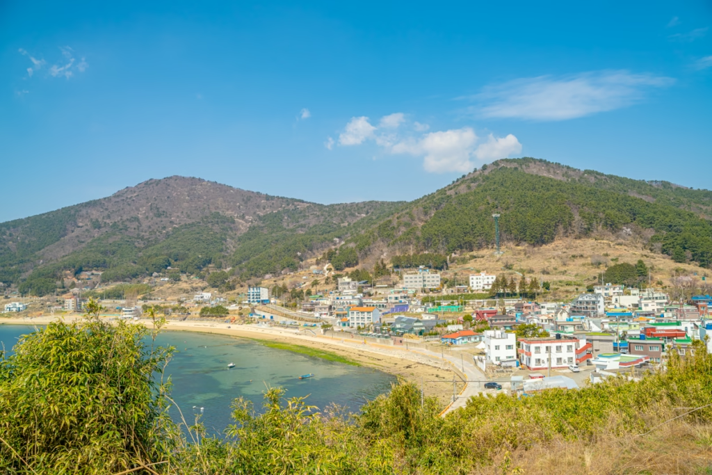
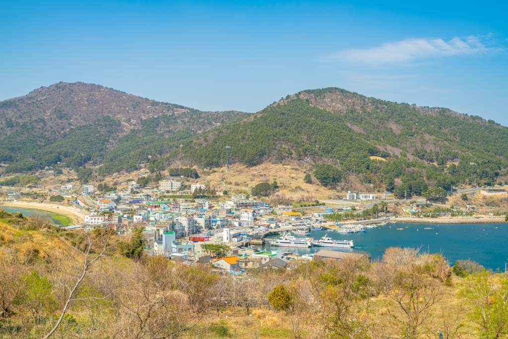
Gujora Village is a tight cluster of fishing houses wrapped around a small harbor. The free public parking lot at Gujora Harbor (구조라항 공영주차장) is the only sensible base for the hike.
The friction here is almost entirely a timing problem. On spring and summer weekends, the same lot serves Oedo Botania ferry passengers, and by 09:30 the lanes are backed up with idling cars. I circled twice on a Saturday in late March before giving up. The local fix: an unmarked gravel shoulder 600m north of the main lot, just past a blue utility box on the left. It holds eight to ten cars and is where the regulars park. Arriving before 08:30 on a weekend morning eliminates the problem entirely.
Guesthouse availability around Gujora Harbor during spring bloom season runs tight — two to three weeks out on long weekends. I’ve made the mistake of showing up without a booking once; it’s not a mistake worth repeating.
[Search available rooms near Geoje Gujora]
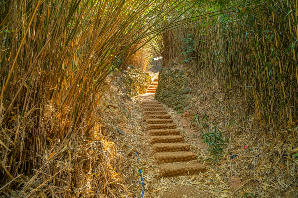
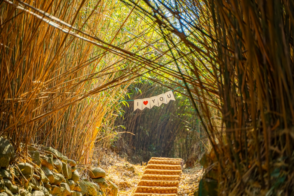
Walking the Saetbaram Sorigi-gil Bamboo Tunnel
From the parking lot, the route threads through a short run of village mural walls before the trailhead sign for Saetbaram Sorigi-gil (샛바람소리길) appears at the end of the main lane. It’s easy to miss if you’re looking at your phone rather than the hillside.
The name translates roughly to “the path where the easterly wind sings.” I noticed — on a cool April morning with a steady sea breeze — that it actually does. Not dramatically: the bamboo here is siritdae (시릿대), a low-growing dwarf variety, and the sound it makes in the wind is drier and more deliberate than the romantic swaying you might picture. Closer to someone slowly turning the pages of a large, paper-heavy book.
The grove itself wasn’t planted for aesthetics. Generations of Gujora villagers established it as a windbreak against the fierce easterly gales — saetbaram — rolling in off the Korea Strait. The canopy closes tightly overhead, dropping midday summer temperatures to something genuinely tolerable. In April, the filtered light has a cold, glassy quality — everything underneath sits in permanent blue-green shade regardless of what the sky is doing above.
The practical irritation with the tunnel is the exit. The trail opens onto the ridge without warning, and the first full view of the sea arrives before you’ve had time to prepare for it. I’ve been here three times, and every time that moment feels slightly unearned — as if the forest held everything back and then surrendered it all at once.
One detail worth knowing in summer: the bamboo section is well-shaded but noticeably insect-heavy. Long sleeves aren’t excessive. The full tunnel crossing takes around ten minutes at a relaxed pace.
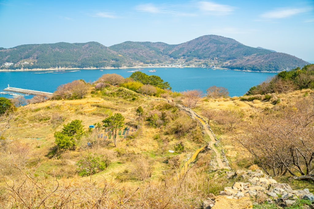
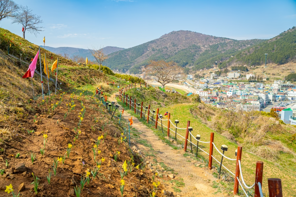
The Ancient Walls & Hallyeohaesudo View
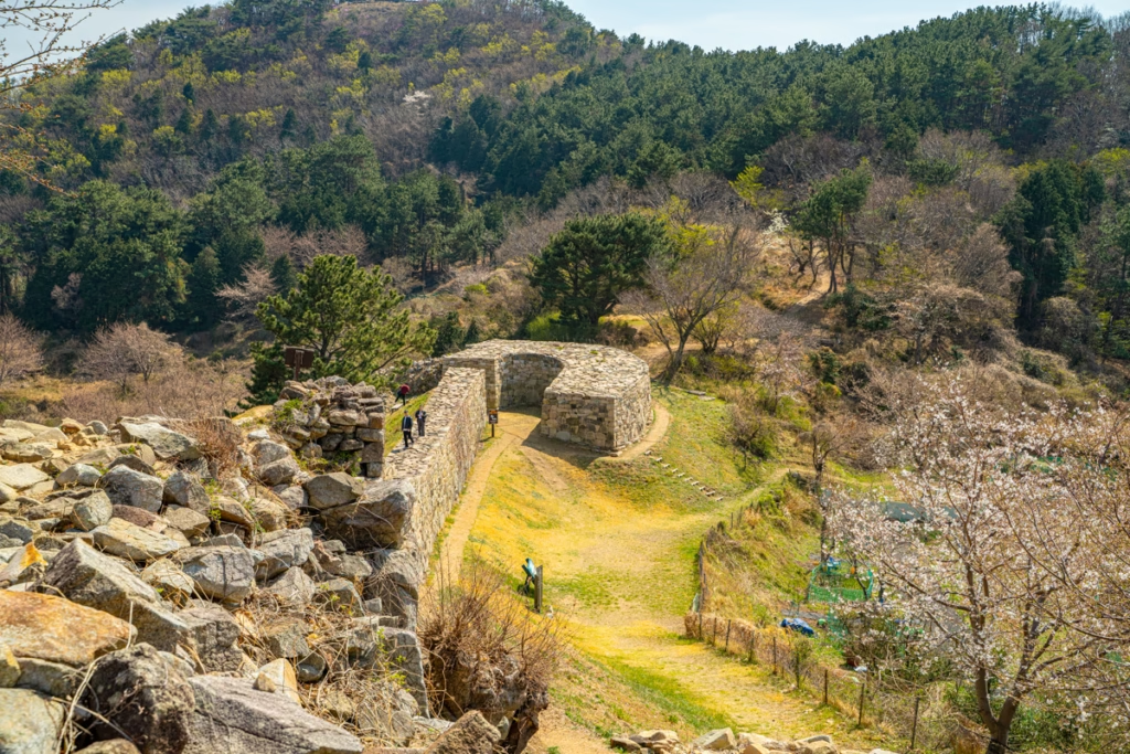
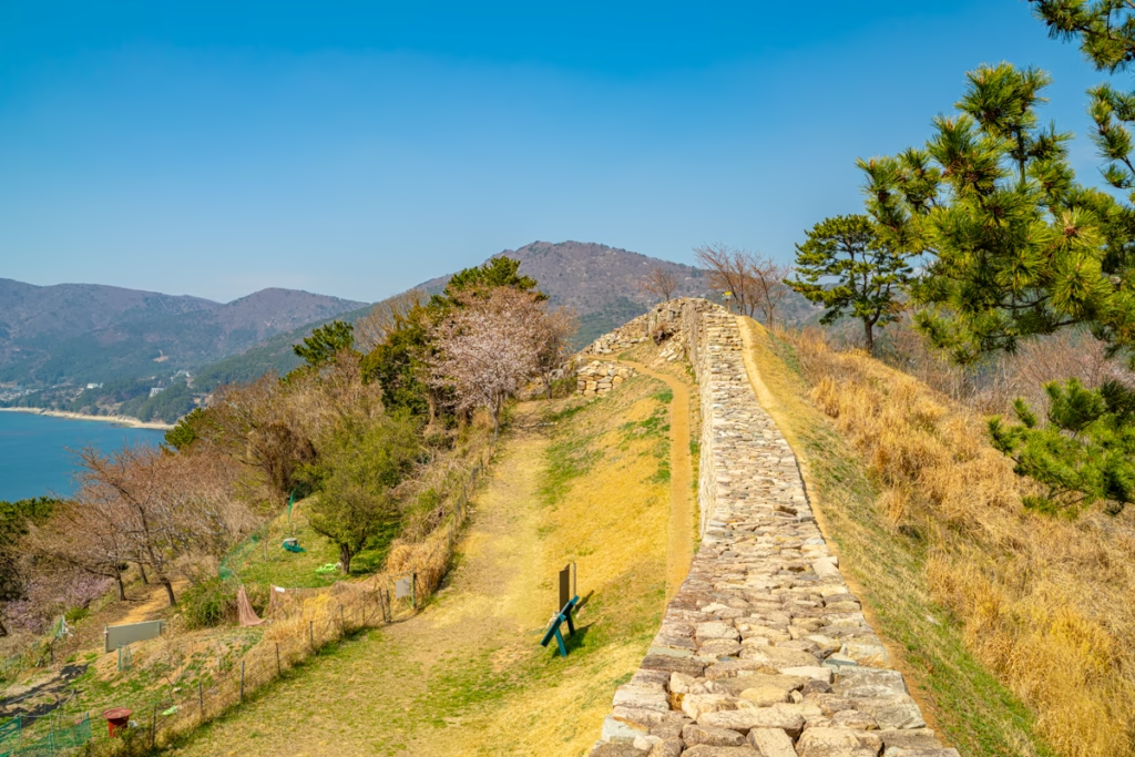
The wall emerges from the ridge in a way that looks almost geological — low, grey, moss-patched stone following the natural contour of the hill rather than imposing on it. The fortress was constructed in 1490 during the reign of King Seongjong of Joseon as a forward position against Japanese coastal raids, functioning as an outpost for the larger Jisepo Fortress that guarded the strait facing Tsushima Island. The name Gujora (舊助羅) is said to derive from the turtle-neck shape of the surrounding coastline — and standing on the wall looking down at the village and harbor below, that interpretation stops feeling like a stretch.
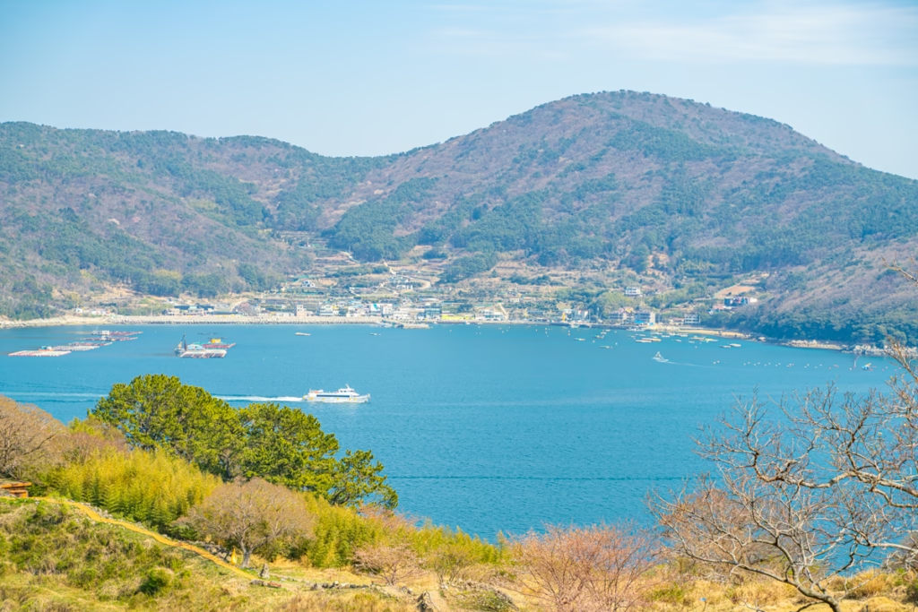
What the photos absolutely don’t show is how narrow the walkable surface actually is. I expected a broad parapet. It’s roughly one meter across, slightly convex, with no railing on either side. On my last visit, the wind shifted without warning and came in hard off the water; I stepped back down to the base of the wall and shot from ground level instead. The composition from below — angled up along the stone face with Yundol Island (윤돌섬) sitting in the middle distance — is stronger than anything from the top anyway.
The water of Hallyeohaesudo on a clear morning sits at a color temperature between grey-green and deep teal, depending on cloud cover. Yundol Island floats in the middle distance like a dark comma. The ferry lanes are visible as faint white lines threading between the southern islands. On a weekday morning before the first Oedo departure, you may have the entire wall to yourself.
Honestly, I almost turned back when the trail pitched upward just before the crest — loose shale underfoot, hands-on-knees territory for about four minutes. It passes. The view does not.
Spring Blooms: Daffodils, Peach Blossoms & Cherry Timing
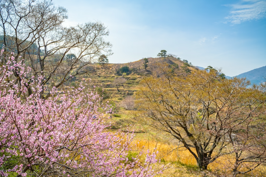
The thing no one mentions is that the flowers here are not a managed display. There are no roped-off beds, no countdown boards to peak bloom. The narcissus (수선화), peach blossoms, and cherry blossoms grow along the trail banks and in the gaps of the stone wall itself — you find them mid-stride, not upon arrival.
Late March to early April runs the full sequence: narcissus opens first on the south-facing slopes, pale yellow and faintly sweet-smelling in the cold morning air, the kind of scent that registers as “clean” rather than floral. Peach blossoms follow within a week, the branches still barely leafed so the pink reads clearly against grey stone and teal water below. The overlap window — when all three are simultaneously visible — is typically three to five days and shifts by one to two weeks depending on the severity of the preceding winter.
My first instinct was wrong. I assumed the blooms would be concentrated along the bamboo tunnel section. In reality, the densest flowering is on the exposed ridge near the fortress wall, where the south-facing stone absorbs enough heat to push the bulbs early. The bamboo section stays green and cool regardless of season.
If narcissus is your specific draw, Gonggoji (공곶이) near Yeguma Village is a 20-minute drive east along the coast. In mid-March, the terraced hillside runs continuous yellow from the ridge down to the shore — a completely different scale from anything at the fortress.
If you’re building a wider spring road trip through South Gyeongnam, catching the early red plum blossoms at Tongdosa makes a strong opening day — the temple is about 90 minutes north of Geoje by car and the plum season runs two to three weeks ahead of the fortress blooms.
Practical Notes: Parking, EV Charging & Trail Safety
Visiting Gujora Fortress Geoje Island is straightforward — the only variable is timing.
Free Parking at Gujora Harbor
The harbor public lot is free and spacious on weekdays. On spring and summer weekends, the Oedo Botania ferry crowd shares the space, and it fills before 09:30. The unmarked gravel shoulder 600m north — past the blue utility box on the left — is where the locals go when the main lot is gone. Eight to ten cars fit comfortably. Arriving before 08:30 on a weekend morning removes the problem entirely.
EV Charging Near the Fortress
The nearest DC fast charger is at Ilun-myeon Community Center (일운면사무소), approximately 3km from the harbor. It’s a 50kW unit — budget 35 minutes to move from 20% to 80% on a mid-size EV. There’s a convenience store 100m away, which makes the stop functional rather than frustrating.
Trail Safety Checklist
There are no facilities on the trail once you leave the harbor area. Use the bathroom near the harbor before starting and carry at least 500ml of water per person. In spring and autumn, trail signage includes warnings about snake sightings on the upper ridge — staying on the marked path is the full extent of the mitigation required.
Footwear is non-negotiable: sneakers at minimum. The shale section near the wall crest is uneven enough that anything without grip becomes a genuine hazard. The trail has no lighting — daylight visits only.
Practical Manual
| Category | Details |
|---|---|
| Exact Address | 경남 거제시 일운면 구조라리 산55 / Gujorari San 55, Ilun-myeon, Geoje-si, Gyeongsangnam-do |
| Naver / Kakao Map | 구조라성 |
| Admission | Free / 무료 |
| Hours | 24 hours year-round — daylight visit only (no trail lighting) |
| Parking | Gujora Harbor public lot (구조라항 공영주차장) — free; overflow: unmarked gravel shoulder 600m north, past blue utility box on left |
| Nearest EV Charger | 일운면사무소 (Ilun-myeon Community Center) — 50kW DC fast charger, ~3km from harbor |
| Best Time to Visit | Late March–early April (spring blooms); weekday mornings year-round for solitude |
| From Seoul | ~4.5–5 hours by car via Namhae Expressway |
| From Busan | ~1.5 hours by car; or ~1h 40min by intercity bus from Busan Seobu Terminal (₩7,400) |
| Transportation | Rental car or EV strongly recommended; public bus to Gujora is infrequent |
| Estimated Cost | Free (trail + fortress); Oedo Botania ferry if combined: ₩18,000–22,000 adult |
| Recommended Stay | 1.5 hours (bamboo trail + fortress wall + bloom sections) |
| Trail Notes | Sneakers required; no facilities on trail; no railings on fortress wall; snake warnings in spring/autumn; insects in summer bamboo section |
| Nearby | Gonggoji daffodil terraces (공곶이) — 20 min east by car |